There is no doubt that Canada is a hiker’s paradise, and for good reason. There are hikes in Canada for every ability level and type of scenery, whether you want views of mountains, forests, fields of wildflowers or a body of water. We have rounded up 12 of the best hikes in Canada representing eight provinces and one territory. Whether you want a leisurely, easy day hike or a multi-day, difficult journey, our list has it all. We have also provided a difficulty rating – easy, medium or hard – so you can plan better.
British Columbia
West Coast Trail
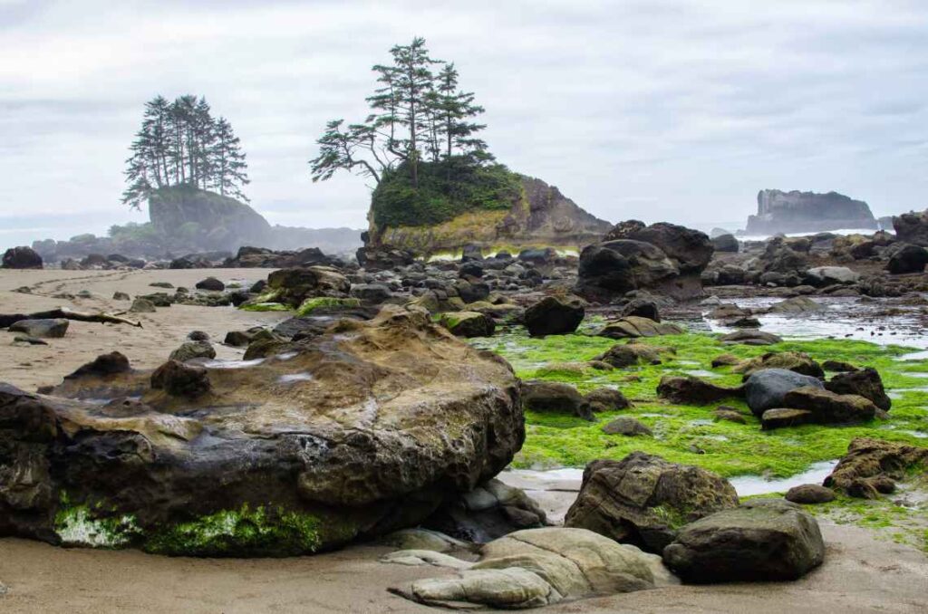
This iconic trail runs through the Pacific Rim National Park Reserve along the Pacific Coast of Vancouver Island. It is intended as a challenging multi-day backpacking trail, and requires hikers to climb more than 100 ladders, and go through water and mud. It is so difficult that Parks Canada has made a preparation guide and video so potential hikers know what they are getting into before making a reservation. The trail follows paths historically used by First Nations people for trade and travel. If you are up for the challenge, this is a hike to put on your bucket list.
Difficulty: Hard
Trail length: 75 km (46.6 miles) in total
Opening dates: Generally from May 1 to September 30
Time to complete: 5 to 7 days total for the entire trail
Reservations required: Yes, they can be made on the Parks Canada website
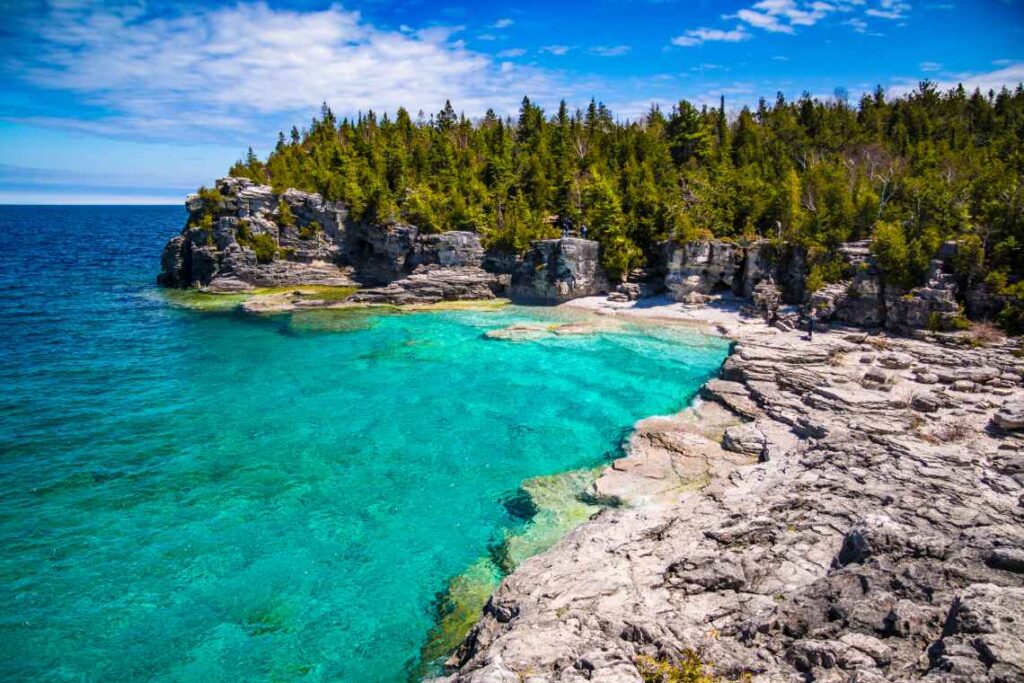
Garibaldi Lake Trail
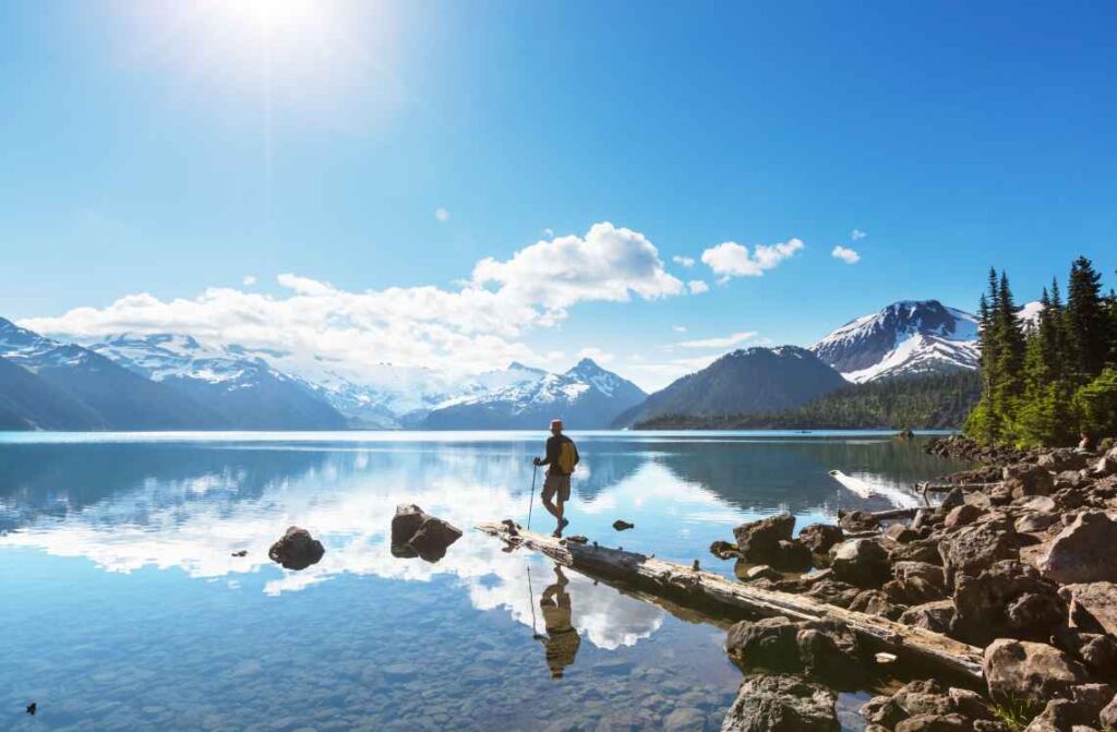
The hike to this alpine lake in Garibaldi Provincial Park rewards you with views of its turquoise blue waters, the surrounding mountains and fields of wildflowers. The trailhead just south of Whistler is easy to reach from Vancouver via the Sea to Sky Highway, aka, Highway 99. Once you reach the trailhead you can choose the longer version of the trail, or hike for around 6 km and take a “shortcut” to Garibaldi Lake by going right instead of left when the trail diverges.
Difficulty: Medium
Trail length: 18 km (11.2 miles) loop
Opening dates: July to October
Time to complete: 6 hours
Reservations required: No
Alberta
Plain of Six Glaciers
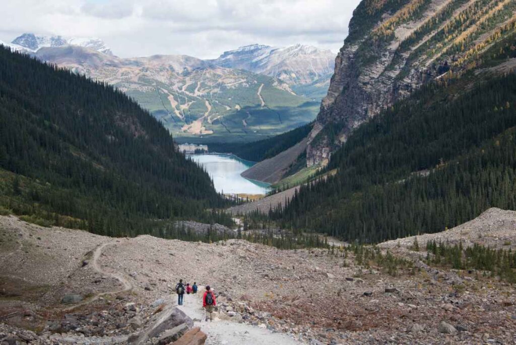
This out-and-back hiking trail starts along beautiful Lake Louise and rises into the mountains in the famous Banff National Park. You can choose to only do the beginning, flat portion of the trail along the lake, or continue on up into the Rocky Mountains where you can connect with the Highline Trail and take in stunning views of glaciers until you reach the Plain of Six Glacier Teahouse for some coffee and cake.
Difficulty: Medium
Trail length: The Plain of Six Glaciers Trail is 5.3 km (3.3 miles) one way. Connect with the Highline Trail for a 14.64 km (9.09 miles) hike that goes further into the mountains for glacier views.
Opening dates: Some access roads and upper portions of the trail are closed in the winter due to avalanche risk. Recommended June to September.
Time to complete: 4 hour roundtrip for Plain of Six Glaciers Trail only; 5 hours roundtrip to the teahouse
Reservations required: No
Skyline Trail (Alberta)
This picturesque trail in Jasper National Park is popular with backpackers who spend 2-3 days completing it. You can, of course, do only a portion of it and make a day hike. Be prepared for muddy conditions and some stream crossings, mosquitos, wildlife and changing weather. But all of this is worth it for the views you get on the trail, half of which is above the treeline.
Difficulty: Hard
Trail length: 45 km (28 miles) out and back
Opening dates: Best done between July and October; snow will make some parts of the trail unaccessible during other months
Time to complete: 15 hours
Reservations required: Only for campsites. You can reserve on the Parks Canada site.
Ontario
The Bruce Trail
This massive trail covers hundreds of miles in Ontario and has been divided into 9 sections that are maintained by volunteers with the Bruce Trail Conservancy. It runs from Queenston, just north of Niagara Falls along the US border, and goes through the Toronto area before ending at Tobermory at the tip of the Bruce Peninsula National Park sitting between Georgian Bay and Lake Huron. A note before you go: Since much of the trail goes through private land with the owner’s permission, you should stay on the marked trail to respect their property.
Difficulty: Medium to hard, depending on the section you hike
Trail length: 890 km (553 miles), broken into 9 segments
Opening dates: Open year-round, although in winter there will be several inches of snow
Time to complete: 30 days on average, although one person did it in 12 days
Reservations required: No, although if you plan to do a multi-day trip you will need to book campsites or other accommodations ahead of time as you cannot camp on private property along the trail.
Quebec
Bras-du-Nord Trail in Vallée Bras-du-Nord
The network of hiking trails in the Vallée Bras du Nord has something for everyone. There are trails you can take the kids on, or more challenging routes for expert hikers. The Bras-du-Nord trail is a favorite for its diversity, with easy sections following a river and steeper sections leading to fantastic views and waterfalls like Delaney Falls.
Difficulty: Medium
Trail length: 13.2 km (8.2 miles) loop, starting and ending at the Shannahan welcome point in Saint-Raymond.
Opening dates: Early June to mid-October
Time to complete: 4 to 5 hours
Reservations required: Yes. You need to buy a daily or annual pass to hike the trails, which you can get online or at one of the welcome points.
Mont-Saint-Alban
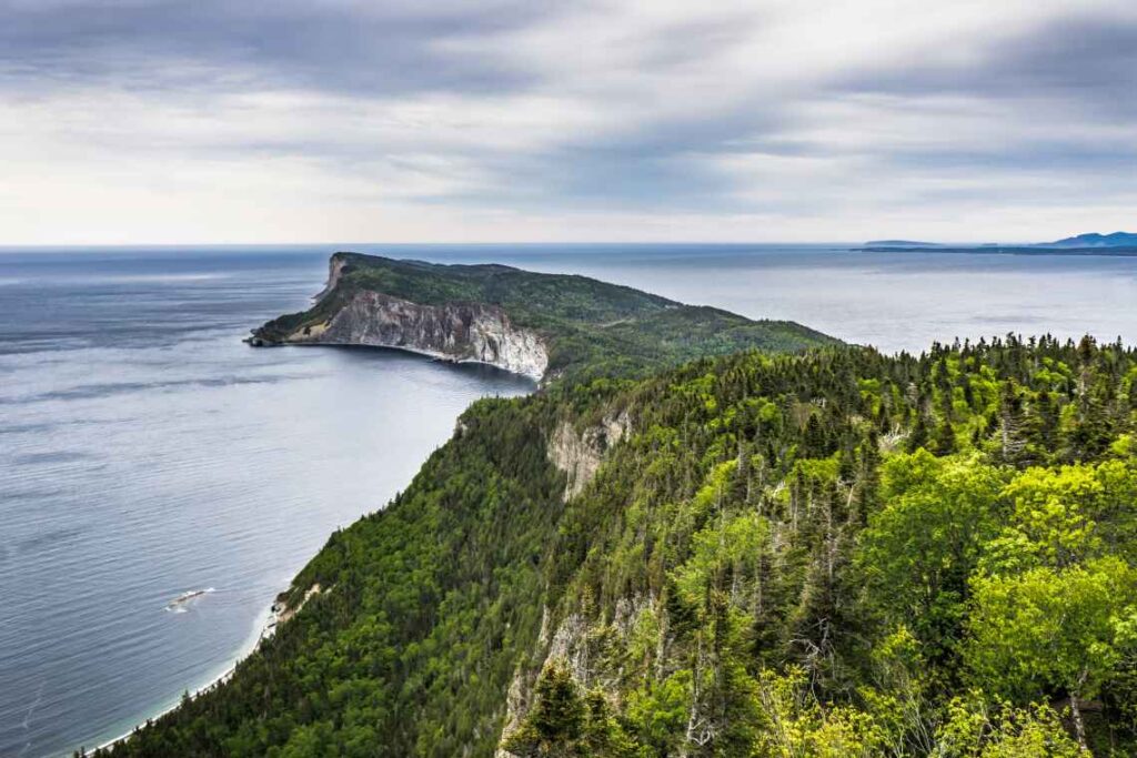
This hiking trail in Forillon National Park rewards you with a panoramic view from an observation tower, along with views of the Gulf of St. Lawrence and maybe even some whale sightings. Relax on rocky beaches and rest your feet as your
Difficulty: Medium
Trail length: 7.8 km (4.8 miles) loop from Cap Bon Ami, or 7.2 km (4.5 miles) loop from Petit-Gaspé Beach
Opening dates: Open year-round, although hiking is best from May to October
Time to complete: 2.5 to 3 hours, depending on which loop you choose
Reservations required: Only for camping and backcountry use. An entrance fee is required to enter Forillon National Park for those over 17, and the price depends on what time of the season it is.
New Brunswick
Fundy Footpath
The 30-kilometer-long Fundy Trail Parkway gives you multiple hiking paths to choose from, whether you want an easy walk to do with kids, or something more challenging. Whatever trail you choose, you are likely going to get views of the beautiful Bay of Fundy, and will come across beaches and other noteworthy scenery.
One of the best hikes in the area is the Fundy Footpath. Most of the trail sits outside the park, but its the path’s scenery through the wilderness has put it on the list of the best hikes in the world. You can access it at the Big Salmon River Visitor Center at the Fundy Trail Parkway. You’ll have to hike 9 km (4.6 miles) on the Goose River Trail to get to the Fundy Foothpath, and then it’s 41 km (25.4 miles) to its end at the edge of Fundy National Park.
Difficulty: Hard
Trail length: 41 km (25.4 miles) one way
Opening dates: Mid-May to mid-October. Also keep in mind the daily park hours so you don’t get locked in or outside of the park gates
Time to complete: 4 to 5 days
Reservations required: No, although if you leave a vehicle parked in the Fundy Trail Parkway, you will need to register it. If you don’t register the vehicle and it is unoccupied for 48 hours or more, it may be reported to the authorities.
New Brunswick & Labrador
East Coast Trail
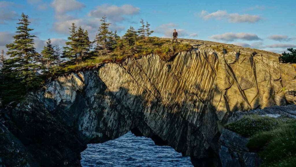
Hike along the easternmost coast of North America on the collection of 25 wilderness paths known as the East Coast Trail. You can choose a path that fits your abilities and get great views of the Atlantic Ocean, see abandoned settlements, fjords, lighthouses, whales, caribou and maybe even an iceberg or two.
Difficulty: Easy to strenuous, depending on the path
Trail length: There are 336 km (209 miles) of trails comprising the East Coast Trail
Opening dates: Open year round, but recommended from April to November for less snow and ice. No trail maintenance takes place from December to March
Time to complete: There are options starting at 2 hours one way, up to 10 hours one way
Reservations required: No
Nova Scotia
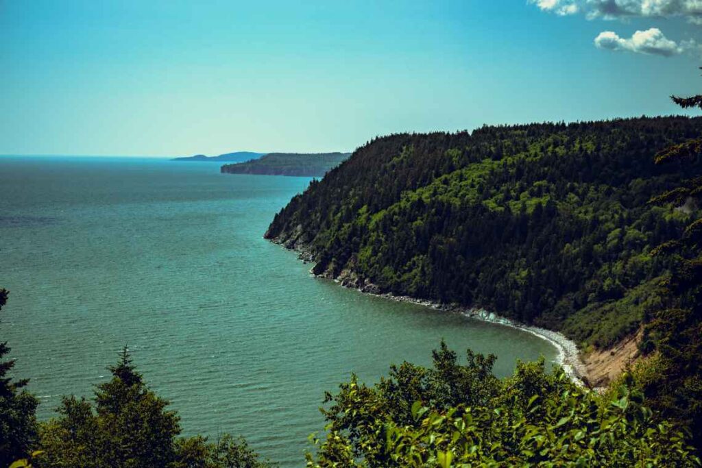
Skyline Trail (Nova Scotia)
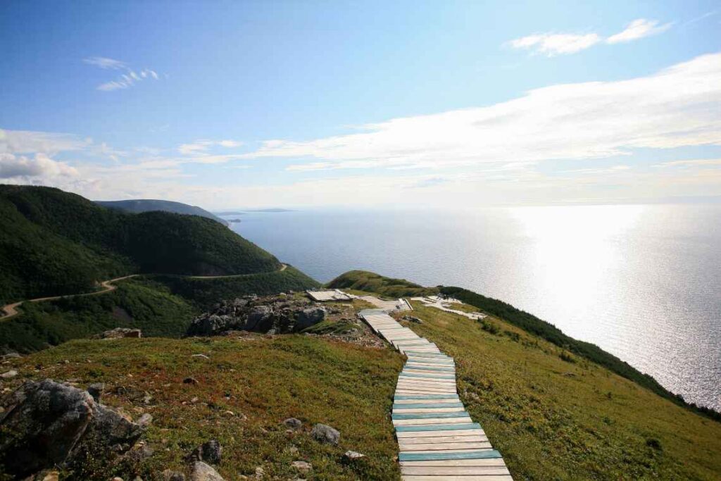
This trail in the Cape Breton Highlands National Park in Nova Scotia gives you fantastic views of the Gulf of St. Lawrence, and you can keep your eyes peeled for wildlife like bears, bald eagles, moose and birds. The trail is an easy one, with some steps at the end, and requires you to stay on a boardwalk in order to protect fragile plant species.
Difficulty: Easy. There is a boardwalk with steps at the headland, which won’t be suitable for strollers or those with mobility issues.
Trail length: 8.2 km (5.1 miles) loop
Opening dates: Open year-round, with full visitor services from mid-May until mid-October
Time to complete: 1.5 to 3 hours
Reservations required: No, although you need a park pass and to pay a park entry fee in order to use the hiking trails.
Manitoba
Blue Lakes Trail
You can find our lone entry from Manitoba in the Duck Mountain Provincial Park. The trail goes in a loop along the shores of East Blue Lake and West Blue Lake and is mostly easy, with flat terrain and rolling hills and some steep slopes. This hike is not recommended for young children.
Difficulty: Easy to medium
Trail length: 5.5 km (3.4 miles)
Opening dates: Open year-round, although in winter months it’s better to go cross-country skiing or snowshoeing on the trail
Time to complete: 2.5 hours
Reservations required: No. You will need to purchase and display a vehicle permit for parking in the park either online or at a local retailer or park office
Yukon Territory
Grizzly Lake Trail
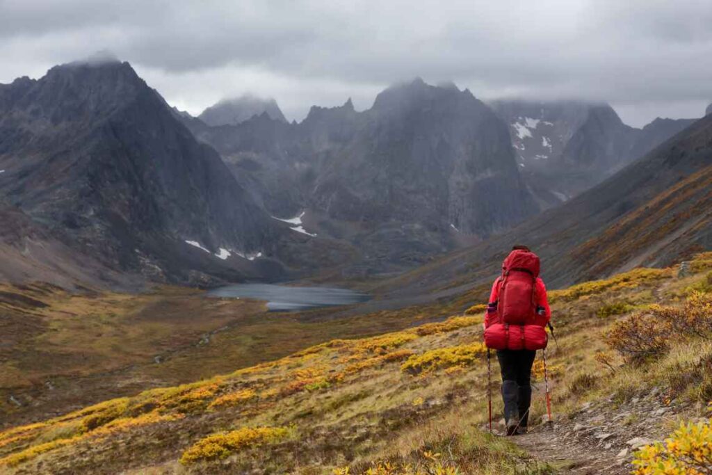
Take in the scenery of the untouched Yukon by tackling this difficult trail that starts just off the Dempster Highway in Tombstone Territorial Park north of Dawson City. Luckily, it follows a portion of the well-marked Grizzly Ridge Trail and takes you through both rocky areas and alpine meadows before you get to Grizzly Lake. Note that this is intended to be an overnight hike (there is a campground at the lake) or part of a multi-day hike combined with other trails.
Difficulty: Hard
Trail length: 11 km (6.8 miles) one way
Opening dates: Generally late June to mid-September, depending on the weather conditions and wildlife
Time to complete: 6 to 9 hours one way to Grizzly Lake
Reservations required: No, although you will need to pay to use a campsite at the Grizzly Lake campground. You also need to register at the Tombstone Territorial Park interpretive center when using the trail, attend an orientation center and rent a bear-proof container if you are camping.